NatureServe Canada’s Ecosystem-based automated range maps (EBAR) initiative is developing publicly accessible range maps for species across Canada.
Combining the best available species data with automated range map generation and expert knowledge, NatureServe Canada’s EBAR maps are supporting KBA identification for species from coast to coast. The EBAR initiative also supports priority programs such as environmental impact assessments, status assessments by the Committee on the Status of Endangered Wildlife in Canada (COSEWIC), Species At Risk Act recovery action plans, and provincial and territorial Species at Risk programs and legislation.
Find out more about the EBAR initiative, including how to download EBAR maps and how to contribute to the process, here.
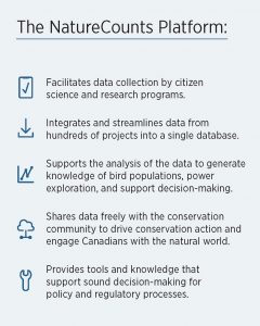
NatureCounts is an open data platform that collects, interprets, and shares biodiversity data. Hundreds of millions of wildlife occurrence records from hundreds of research and citizen science projects can be accessed via the NatureCounts explore tool.
Comprehensive, long-term data from NatureCounts support the identification and evaluation of KBAs, and ultimately the fulfilment of Canada’s commitments to the Kunming-Montreal Global Biodiversity Framework. Data from NatureCounts are extensively used for impact assessment, species assessment, land-use planning, research, and more.
NatureCounts is a program of Birds Canada, to learn more visit www.naturecounts.ca.